Planning
Council approved the Richland County Comprehensive Plan on December 15, 2009. The plan serves as the official statement of the county’s growth management policy and recommendations intended to guide growth & development over the next 20 years.
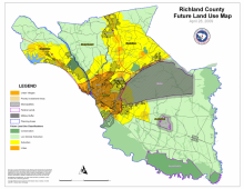
The Comprehensive Plan is organized into nine Elements. They are Population, Housing, Cultural Resources, Natural Resources, Economic Development, Transportation, Priority Investment, Community Facilities, and Land Use. Each Element includes an inventory of existing County conditions, a statement of needs and goals, as well as implementation strategies to achieve these goals.
The overall goals of the Plan evaluate population growth and changes, identifying where people live and work, in addition to identifying and protecting the County’s natural and cultural resources. Furthermore, the Comp Plan addresses issues of land use in an effort to accommodate changes to the population, housing, and economy.
Richland County’s Development Services staff utilizes...
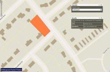
All parcels of land within Richland County are maintained by the Richland County Assessor’s Department for taxation purposes. All parcel information is maintained by the Assessor's Office within the GIS database. Parcel information can be obtained through the Richland County GIS Online Mapping Site or through the Assessor Search Page.
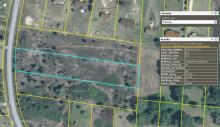
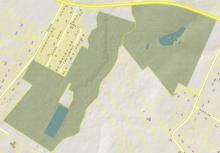
A conservation easement is an agreement between a landowner and a qualified conservation organization or other government agency to preserve an area of land. These parcels of land are donated for conservation purposes only. There are many benefits to donating a conservation easement which can be found on the Conservation Easement Program’s webpage.
Richland County IT/GIS operates and maintains internal and external infrastructure to support County geospatial operations. This equipment includes a number of critical servers that house in excess of two terrabytes of geospatial data and dozens of web services and internally hosted solutions. As data expands and use of services continues to grow, Richland County IT/GIS scales resources accordingly while operating as efficiently as possible.

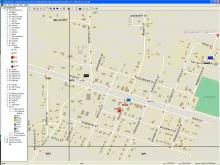
Richland County and Columbia Richland Communication Center (CRCC911), a multi-agency dispatching center, have implemented a state of the art Tritech Computer Aided Dispatching (CAD) with integrated GIS mapping using RCGEO data, Bradshaw Consulting Services MARVLIS Automated Vehicle Location (AVL), and Cassidian PlantCML Sentinel Wireless Phase II compliant phone system to assist mission critical dispatching needs for the citizens of Richland County. CRCC911 staff process approximately 750,000 911 and administrative phone calls per year. Approximately 77% of these calls are wireless. Knowing the location of each call is a necessity. When a wireless call is process, the latitude and longitude are provided for the location. Because of integrated mapping, this location can be viewed within the CAD mapping to support with dispatching. Once the location has been verified, the location is geocoded to the closest street segment, which will provide an address range to send vehicles. Using AVL, dispatch can...
Delinquent properties are parcels of land where the owner has not paid their taxes. A tax sale is held every year in which these properties are auctioned off at the Township Auditorium. The IT/GIS department maintains an application for citizens to view these parcels that will be up for auction. This application is only available for 30 days prior to the auction. Visit the Richland County Treasurer's webpage for more information